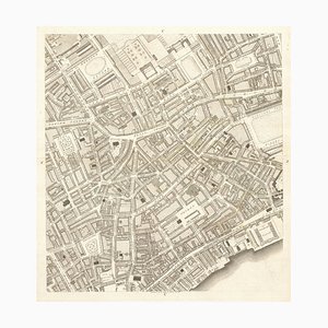
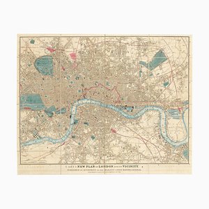
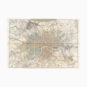
Covent Garden and Soho from a Large-Scale Survey of London
SEK 28,007
You are now following Wall Decor. You can manage alerts in your account settings.
You have unfollowed Wall Decor.
Covent Garden and Soho from a Large-Scale Survey of London
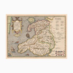
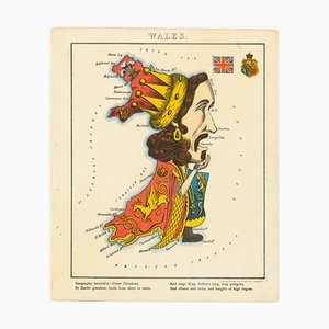
Early 17th Century Map of Wales, 1619
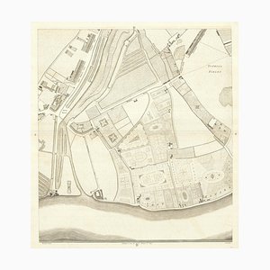
Pimlico and Belgravia from an Important Large-Scale Survey of London
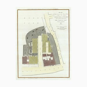
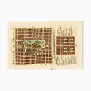
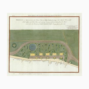
Plan to Redevelop the Corner of Park Lane and Piccadilly
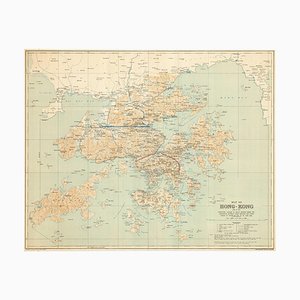
Map of the Environs of Hong Kong

18th Century Town Map of Peking
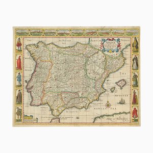
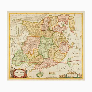
Classic 17th Century Carte-À-Figure Map of Spain
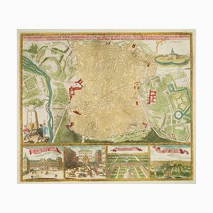
Detailed Town Plan of Madrid
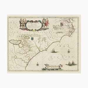
Virginia & Florida Map, 1600s
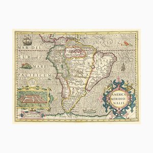
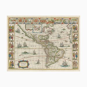
Early 17th Century Dutch Map of South America, 1633
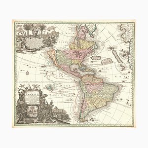
Map of The Americas with California as an Island, 1700s
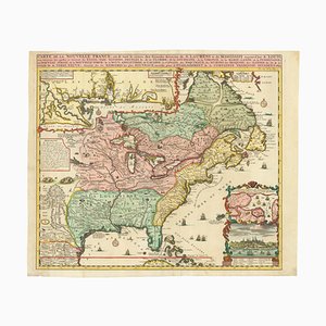
Map of North America During the Mississippi Bubble
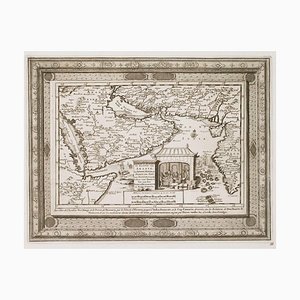
18th Century Map of Arabia with a Fine Border
Detailed Map of London During the Great Exhibition of 1851
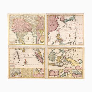
Four-Sheet Wall Map of the Far East, Set of 4
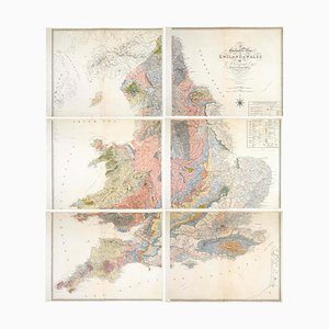
Geological Map of England and Wales on Six Sheets, Set of 6
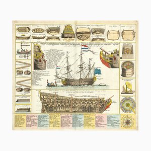
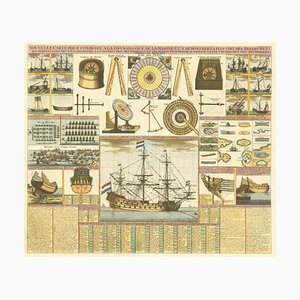
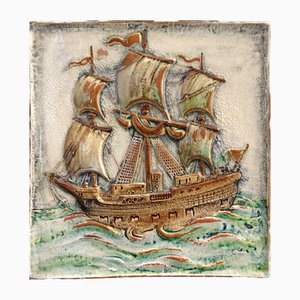
Decorative Marine Print of Early 18th Century Warships
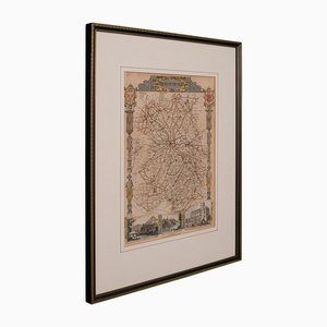
Issue of John Speeds Map of Hampshire
17th Century Panelled Map of the Holy Land
Incunable Map of Arabia with Lapis Lazuli Blue
Caricature Map of Wales
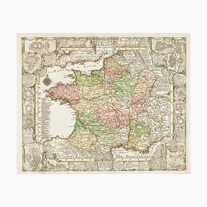
Map of France Celebrating the Military Successes of Louis XIV
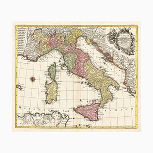
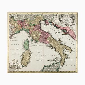
18th Century Map of Italy in Bright Colour
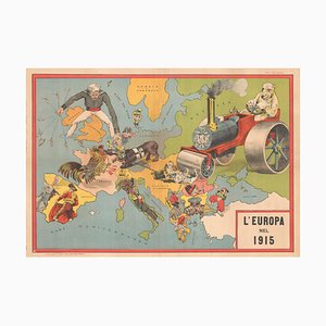
Italian Serio-Comic Map of Europe During the Great War, 1890s
Decorative Map of Malta Celebrating the Knights by Enzo Mari
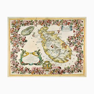
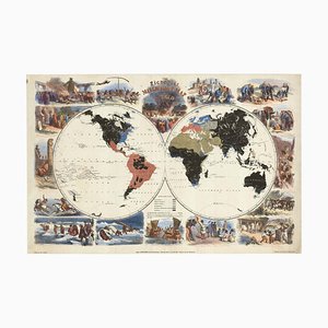
Figure Map of America
18th Century Map of Italy in Fine Colour
18th Century Map of the Papal States
18th Century Maritime Explanatory Print
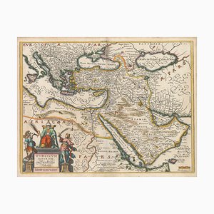
17th Century Map of the Turkish Empire
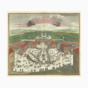
Birds-Eye View of Louis XIV Court at Versailles
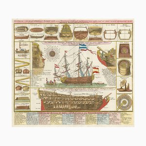
Early 18th Century Warship Chart
The Peregrinations of Abraham, 1603
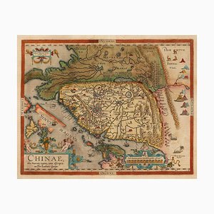
Orteliuss Landmark Map of China
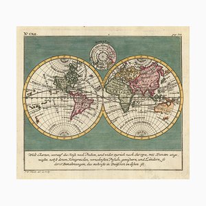
18th Century Double-Hemisphere World Map
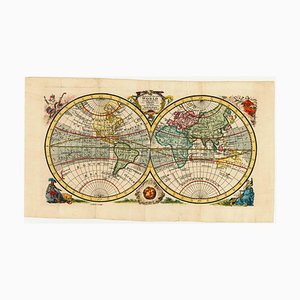
English Double-Hemisphere World Map Showing Discoveries
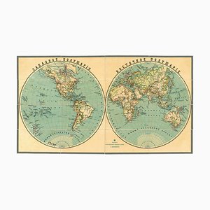
Late 19th Century Double-Hemisphere World Map in Cyrillic
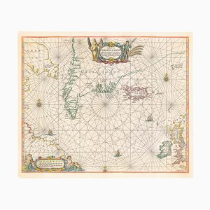
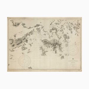
17th Century Dutch Sea Chart of the North Atlantic
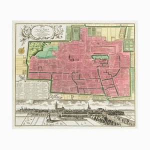
18th Century Town Plan of the Hague
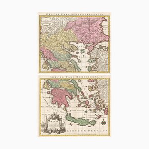
18th Century Two-Sheet Map of Ancient Greece from Aeg
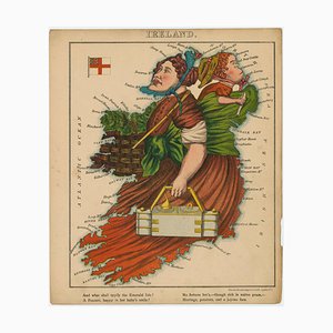
Satirical Map of Ireland
Map of the Environs of London in Fine Colour
Pictorial Map of Wales
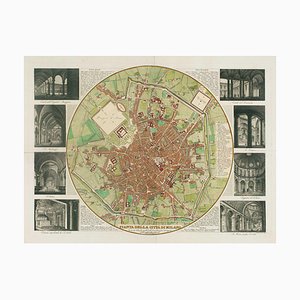
Map of Milan with Vignettes of Interiors
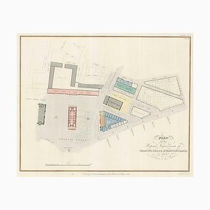
Nashs Plan to Redevelop Charing Cross
17th Century Map of China
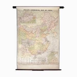
Wall Map Illustrating the Commerce of China
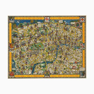
The Famous Wonderground Map of London, 1920s
9th Century American Sea Chart of Hong Kong
Map of Hong Kong, 1890s
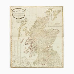
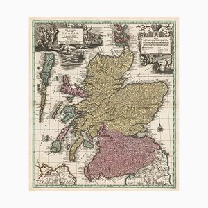
Wall Map of Scotland
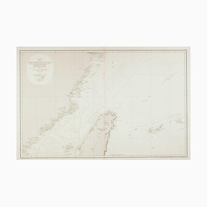
19th Century Spanish Sea Chart of China with Taiwan
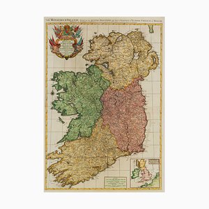
Two-Sheet Map of Ireland
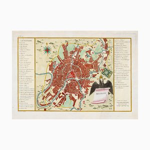
Town Plan of Moscow in the 18th Century
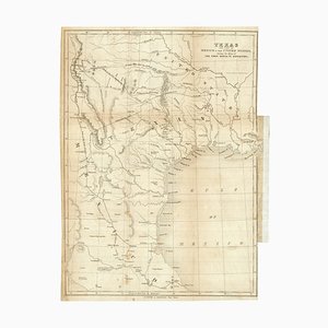
Map of the Republic of Texas
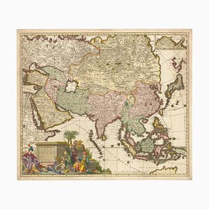
17th Century Map of Asia, 1690
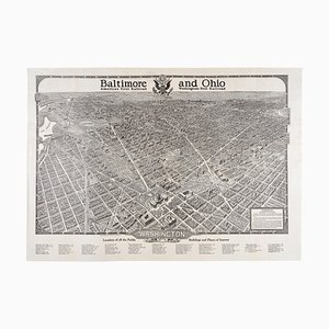
Pamphlet with a Large Birds-Eye View of Washington D.C., 1920s
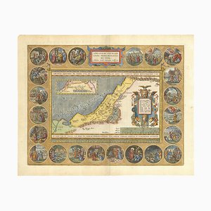
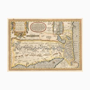
16th Century Map of Ancient Egypt from Aeg, 1601
16th Century Map of the Peregrinations of Abraham, 1603
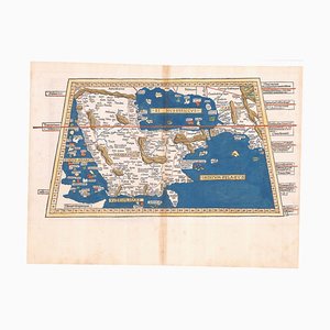
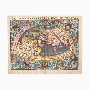
16th Century Woodcut Map of the World According to Ptolemy
The First Plate of Orteliuss Classic World Map, 1584
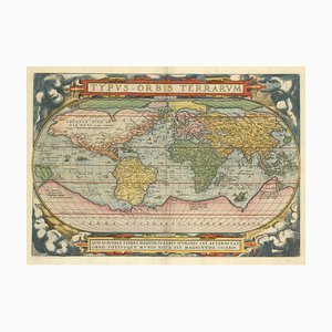
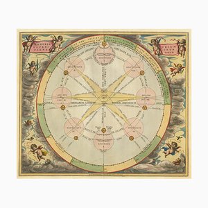
Chart of the Copernican Solar System, 1700s

Chart of the Apparent Motions of Mars, Jupiter & Saturn
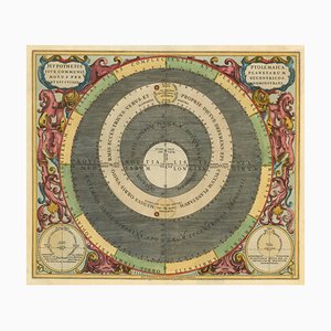
17th Century Celestial Chart Showing the Ptolemaic Planetary Orbits
Pictorial Map of the World Promoting Protestant Missionary Work
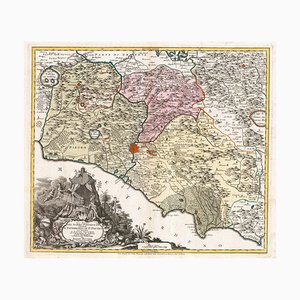
18th Century Map of Tuscany and the Papal States
18th Century Map of Scotland
Art Deco Store Sign, 1930s
Huge Directional Sign Butcher Shop Charcuterie, 1960s

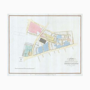
Early 19th Century Map for Houses in Hyde Park by J. Fordyce, 1809
Good Night Neon Sign, 1980s

Glazed Terracotta Vessel Tile Panel by Gustav Heinkel for Majolika Karlsruhe, 1970s
Authentic Wooden Pharmacy Sign, France, 1930

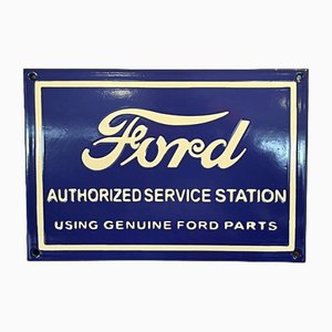
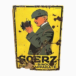
Advertising Garage Enamel Sign
Polaroid Photographs by Miquel Arnal, Set of 4

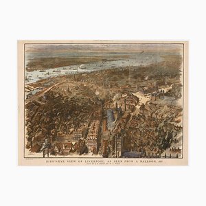
Balloon-View of Victorian Liverpool in Full Colour
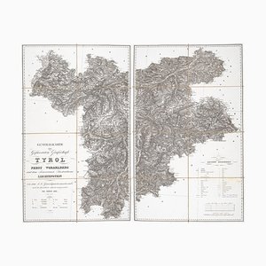
Detailed Map of Tyrol, Vorarlberg and Liechtenstein
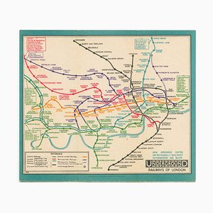
Last Pre-Beck Pocket Map of the London Underground, 1930s
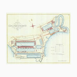
Detailed Plan of Londons Docklands
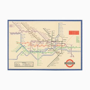
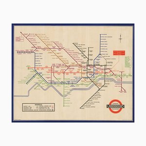
Map of the London Underground, 1930s
Planned Redevelopment of Charing Cross
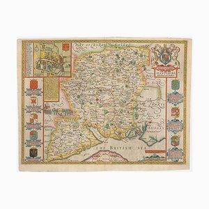
Antique Lithography Map, Shropshire, English, Framed, Cartography, Victorian
Vintage Paddington Fine Toys Wooden Advertising Sign, 1960s

Vintage Wooden Advertising Sign from Abbott & Co., 1950s

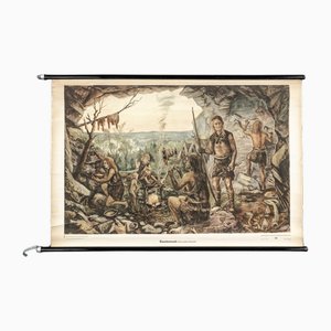
Charts of Maps from Ice Age Man
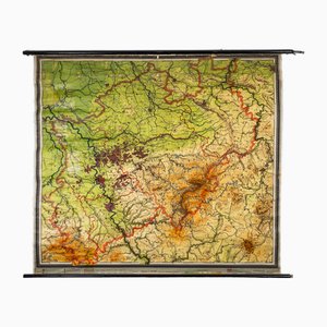
Charts of Physical Maps from North Rhine Westphalia NRW
Folk Art Carved Wooden Advertising Sign, 1920s

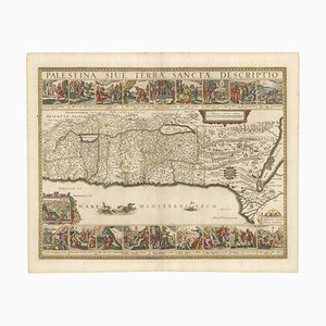
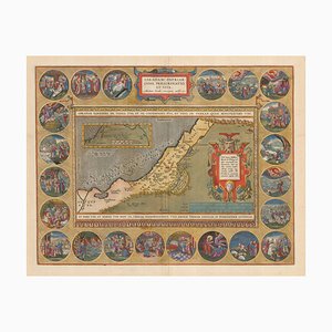
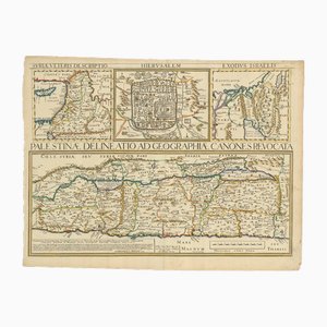
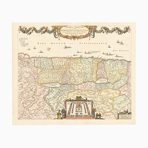
17th Century Map of the Holy Land Palestine, 1641
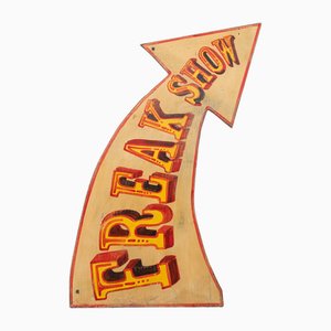
Hand Painted Freak Show Fairground Sign
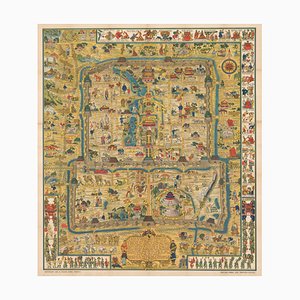
Pictorial Map of Beijing by Frank Dorn, 1936
London Transport Underground A Double Crown Poster Map of the Tube by Beck, 1935
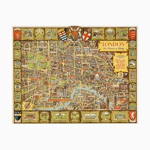
Post-War Pictorial Wall Map of London, 1955
Vintage Tube Poster for Bond Street Station Chart, 1934

17th Century Map of the Holy Land Terra Sancta
Large Advertising Sign in Enamel
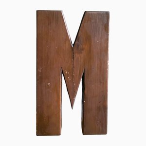
Large Industrial Portuguese Wood Signage Lettering Letter M, 1960s
Trending